
خدماتنا

Dividing a property involves splitting it into several distinct parcels.
This process can take place in various contexts, including:
The distribution of a property among heirs during an inheritance
The creation of buildable plots from an existing land
The transfer of ownership between neighboring parcels
The separation of multiple existing built units
Before any operation, an Expert Surveyor conducts a preliminary feasibility analysis based on the urban planning regulations applicable to the area concerned. Depending on the project, certain urban planning authorizations may need to be obtained (development permit, prior declaration, etc.).
The Expert Surveyor prepares the necessary technical documents: detailed plans of each lot with measurements, areas, updated cadastral references, and any easements. These documents, along with the obtained authorizations, are submitted to the notary responsible for formalizing the sale or division.
The produced documents are then integrated into the national Géofoncier portal, which centralizes the data from Expert Surveyors to ensure their long-term preservation.

Amicable boundary surveying is one of the fundamental missions of the Expert Surveyor. It consists of precisely and permanently defining the limits of a property and then marking them on the ground.
This process can be initiated by a single owner or agreed upon jointly between neighbors. In the case of mutual agreement, the costs are shared among the parties involved.
To establish property boundaries, the Expert Surveyor relies on a thorough expertise combining the analysis of property deeds, land records, and field surveys, all cross-checked with existing cadastral data. The so-called “amicable” procedure involves an on-site meeting to obtain the agreement of all concerned property owners.
Once the operation is completed, the Expert Surveyor provides the parties with a detailed plan along with the official boundary survey report. All these documents are then integrated into the national Géofoncier platform, ensuring secure and permanent preservation of the information.
Boundary surveying provides essential legal security: it protects the exact delimitation of the property, guarantees its area, and preserves the rights attached to each parcel.

Co-ownership applies to buildings that are constructed or under construction. It is based on a legal structure that distinguishes private areas (owned by an individual co-owner) from common areas (owned collectively by all co-owners).
Two situations may arise:
For an existing building, the Expert Surveyor carries out precise surveys to measure and identify each private unit.
In the case of an off-plan sale (VEFA – Sale in Future State of Completion), the units are defined based on the plans provided by the architect.
Establishing a co-ownership requires the preparation of several fundamental documents:
Floor plans, in color, allowing a clear visualization of private areas and avoiding any ambiguity;
Descriptive division statement, which details each unit, specifies the allocation of general and special common areas, and sets the co-ownership shares associated with each unit;
Co-ownership regulations, a legal document that governs the operation of the building and defines the rights and responsibilities of each co-owner.
These elements are essential to ensure clear and fair management of the building, whether for residential, professional, or mixed-use purposes.

The Expert Surveyor uses high-tech equipment to produce highly precise surveys, which are essential for architectural projects.
INTERIOR PLANS
Creating detailed interior plans—whether for a single-family home or a multi-unit building—is a key step in planning any development, renovation, or transformation project. These surveys also allow for determining the various regulatory areas (living area, taxable area, Carrez law area, etc.).
FACADE PLANS
Facade plans accurately represent the exterior appearance of a building. They include all visible architectural elements: openings, roofs, cladding, possible decorations, as well as the necessary altitudes and level measurements for understanding and utilizing the building.
With technical expertise and precise tools, the Expert Surveyor provides the essential graphical documents required for designing, modifying, or enhancing a property.
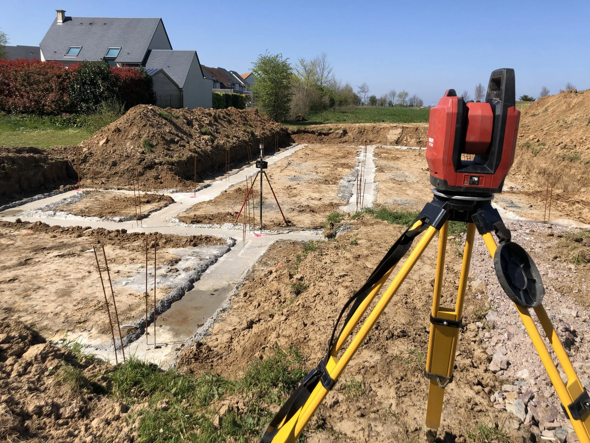
Site layout involves physically positioning on the ground the reference points necessary for the construction of a project, before work begins. This operation can concern the footprint of a house, the structural axes of a building, road alignments, or leveling points.
The Expert Surveyor works upstream to analyze the project, ensure the accuracy of the reference points, and carry out the required checks before approval by the project owner. This ensures that the positioned elements strictly correspond to the provided plans.
The instruments used incorporate high-precision measurement technologies, regularly checked and calibrated to meet the tolerances required for each type of construction.

Topography refers to all techniques used to represent the shapes and reliefs of a terrain in plan, whether natural or modified by human activity. Depending on the project requirements and the desired level of detail, different measurement methods are employed, ranging from simple sketches to high-precision surveys.
Having evolved over centuries, topographic tools now increasingly focus on full digital data capture, facilitating integration into Geographic Information Systems (GIS) or digital models.
The instruments used—equipped with advanced electronic technologies—are regularly calibrated to ensure reliability and accuracy of the surveys. The use of GPS receivers also allows the data to be georeferenced within official coordinate systems, ensuring compatibility with existing cartographic databases.